“Just look at the world around you
Right here on the ocean floor
Such wonderful things surround you
What more is you lookin’ for?
Under the sea
Under the sea
Darling it’s better
Down where it’s wetter
Take it from me”
–Samuel E. Wright, “Under the Sea”
Despite our inauspicious start to the morning due to our run-in with Captain China Virus, we are in good spirits as we head back out towards Jacob Lake, then towards Kenab and eventually the desolate empty interior of Grand Staircase-Escalante National Monument. As with almost every spot on this trip, we would have loved to spend a few more nights exploring the Grand Canyon, but we have to keep reminding ourselves that this is also a ‘move’, not just a vacation. We will eventually come back to many of the spots we visit and stay for an entire vacation. We are just lucky to be able to see all of these amazing places in one almost overwhelming trip; there is so much beauty every day that it is almost too much to record–it is like the memory banks in my brain are full and there is no room to record all of the beautiful spots, everything starts to meld when I try to recall individual locales. I guess that is what the actual camera/phone is for.
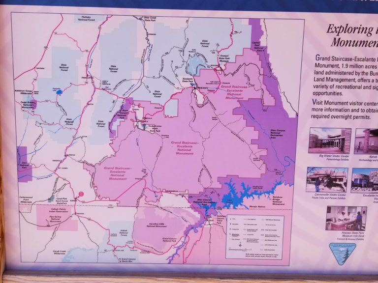
We stop in Kenab one last time to fill up on gas and water (especially the latter) and stop by the BLM office for maps and road conditions. The national monument is nearly 1 million acres and there are very few paved roads aside from the two main highways running east-west that border the park on the northern and southern boundaries. An endless series of dirt roads and 4wd tracks criss cross the park with a handful of main arteries that connect various attractions. We decide to make for one of the more well known routes, Cottonwood Road, which connects highway 89 and highway 12 via 46 miles of washboard dirt road. Although I had a couple the general routes already planned out before we left based on some internet sleuthing and helpful blogs, the ranger station was a must, because the road conditions change and maps are not very reliable (as we would soon find out). The funny thing is that when you look at a normal AAA map (super necessary out here given that we often go whole days with no phone reception) or google map of grand staircase, it is just a giant blank spot on the Utah-Arizona border.
Of course, blank spaces on a map are just enticement to my soul. I often scroll google maps attempting to find areas with little information and plan whole vacations around those locales. That is more or less how we wound up in Abkhazia, the Dientes de Navarino in Patagonia, and the Salar de Uyuni in Bolivia. Blank spaces mean no tourists, friendly locals, open skies, all the stars, and pure bliss. Emptiness on a map gives an area an aura of exploration; that feeling that anything is possible out there in the emptiness. I guess there is just a pull towards the unknown for me, because I know that out in that space there will be a new experience, something that cannot occur at home–an escape from our daily rote. Staring at the blank map, I just keep humming one of my favorite travel songs from my favorite band:
“And we sail out on orders from him but we find
The maps he sent to us don’t mention lost coastlines
Where nothing we’ve actually seen has been mapped or outlined
For we don’t recognize the names upon these signs
And every night finds us rocking and rolling on waves wild and wide
Well, we have lost our way, nobody’s gonna say it outright”
–Okkervil River, “Lost Coastlines”
I first stumbled across Grand Staircase about 6 years ago. When I finished my Ph.D. in 2014, I was extremely lucky to be offered a job almost immediately, but I negotiated a three month window so that I could travel. The 8 year process of obtaining my degree was filled with any number of peaks and valleys; as almost any Ph.D. student will tell you the process is draining and filled with mental anxiety of all types. I had started traveling to some out of the way places while in graduate school (starting with an eye opening trip to Bratislava followed by a number of eastern European countries like Serbia, Bosnia, Croatia, Montenegro, Bulgaria, Macedonia, Greece, Latvia, Lithuania, Poland, and Estonia) and realized how much I enjoyed getting out of my comfort zone, meeting new people from different backgrounds, and just experiencing the world in a more authentic way than I had been accustomed to in the past. I had gone to graduate school straight from my undergraduate degree and I needed some time to explore, to think, to process what had happened in my life over the last 8 years, and to just understand what the hell was going on in the world. Eventually, I hatched a plan to go on the first extended travel of my life, an adventure of epic proportions that would take me completely out of all comfort zones I had ever known. At first it was sort of a pipe dream that I would ponder in particularly tough and depressing times sitting in my barren studio apartment in the heart of the, in its own way, desolate New Bedford, Massachusetts. But, the more I thought it out, I realized I needed to go out in the world and expose myself, get out from under some of my fears and shyness–just get out there in the world, wherever ‘there’ was. I saved money over the last year, made plans, and this trip became one of the few things helping to push me over the last hurdles of my Ph.D. ‘There’ turned out to be Pakistan, India, Nepal, and Myanmar and the trip, although much too short, was everything I needed–enlightening, grounding, and energizing. When I returned to the USA and finally got to Miami to start my new job, I found out that my background paperwork had been lost and that my fingerprints had ‘gotten wet in the mail’ and were unusable. Classic government ineptitude and bureaucracy. Oh well. I found a house to rent and bought a one way ticket out west. I figured I would return when I was told I could start my job, meanwhile I would continue my travels and see the great wide open west that I had dreamed of for so long. I landed in Salt Lake City, rented a car, and beelined for Grand Tetons and Yellowstone. I wound up spending 4 weeks camping, hiking, and road trippin’ solo across all of the major National Parks including Grand Tetons, Yellowstone, Craters of the Moon, Yosemite, Sequoia, climbed all 14,505 feet of Mount Whitney, Death Valley, Zion, Bryce Canyon, Capitol Reef, and ending with a mesmerizing drive through Grand Staircase. My last few days in and around Grand Staircase were empty, vast, wild, barren, and enchanting; I was simply in love with this little corner of Utah that I seemed to have all to myself. Unfortunately, I had a dinky economy rental car, which, although I pushed it to its limits and across many dirt roads that the rental car company was probably not too thrilled about, could not handle exploration of the depths of Grand Staircase. So I promised myself that one day I would come back here with a more appropriate vehicle and really ‘get in there’ and explore. Six years later here we are with the 4wd fordosaurus ready to tackle as many of these dirt tracks as possible.
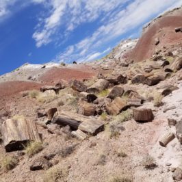
A strong facet of my fascination with Grand Staircase emanates from my passion for rocks. If I pursued another degree, it would probably be in geology. I barely know igneous from sedimentary, but there is just something eternal about rocks that speaks to me. Closely related, I LOVE fossils. The contemplation of plate tectonics and dinosaurs and sedimentation and fossils is all so mesmerizing. I bet I could spend my entire retirement taking courses just on the geology of the Colorado Plateau and never be satiated with my understanding of its insane dynamics. I also think I could spend a decade traipsing around this colorful, horrible, amazing, desolate, flat, mountainous, abysmal pace and never tire of it. As noted in a previous post, the Grand Staircase is actually a series of sedimentary deposits where each ‘step’ represents a different geologic epoch spanning over 600 million years of earth history in just under 100 miles. The staircase builds up from the Colorado Plateau (with the Grand Canyon and Kaibab Plateau representing the oldest geologic era) with five main steps, which starts at Vermilion Cliffs (200 million years old) with the top of the staircase being Bryce Canyon (30-50 million years old). As you proceed through the staircase from south to north you climb vertically through space and time in a kaleidoscope of colors–Vermilion Cliffs, Pink Cliffs, Chocolate Cliffs, White Cliffs, Grey Cliffs–reflected in the sandstone and eroding badlands; hoodoos and balanced rocks, plateaus, cliffs, buttes, domes, but, mostly, wasteland, epic and mesmerizing wasteland.
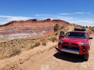
Perhaps the best way to describe a drive through Grand Staircase, though, would be like you are maneuvering a mars rover across the sea floor given that the entire area was underwater at different points in earth history; each sedimentary layer is a different color based on the sediments trapped there when they were deposited at various geologic epochs. For much of the drive I am envisioning myself at the helm of an underwater rover, Kristen and I just cruising across the sea floss with spinosaurus lurking overhead. Periodically, I swerve to avoid a pothole, but, in my own mind, I see a giant trilobite crawling in front of our car-rover and I wave at the underwater bug as we pass. Periodically, I start singing ‘Under the Sea’ from Disney’s ‘The Little Mermaid’ and Kristen gives me a slightly perplexed laugh-look, if she didn’t know better she might think I was a little touched; I probably am.
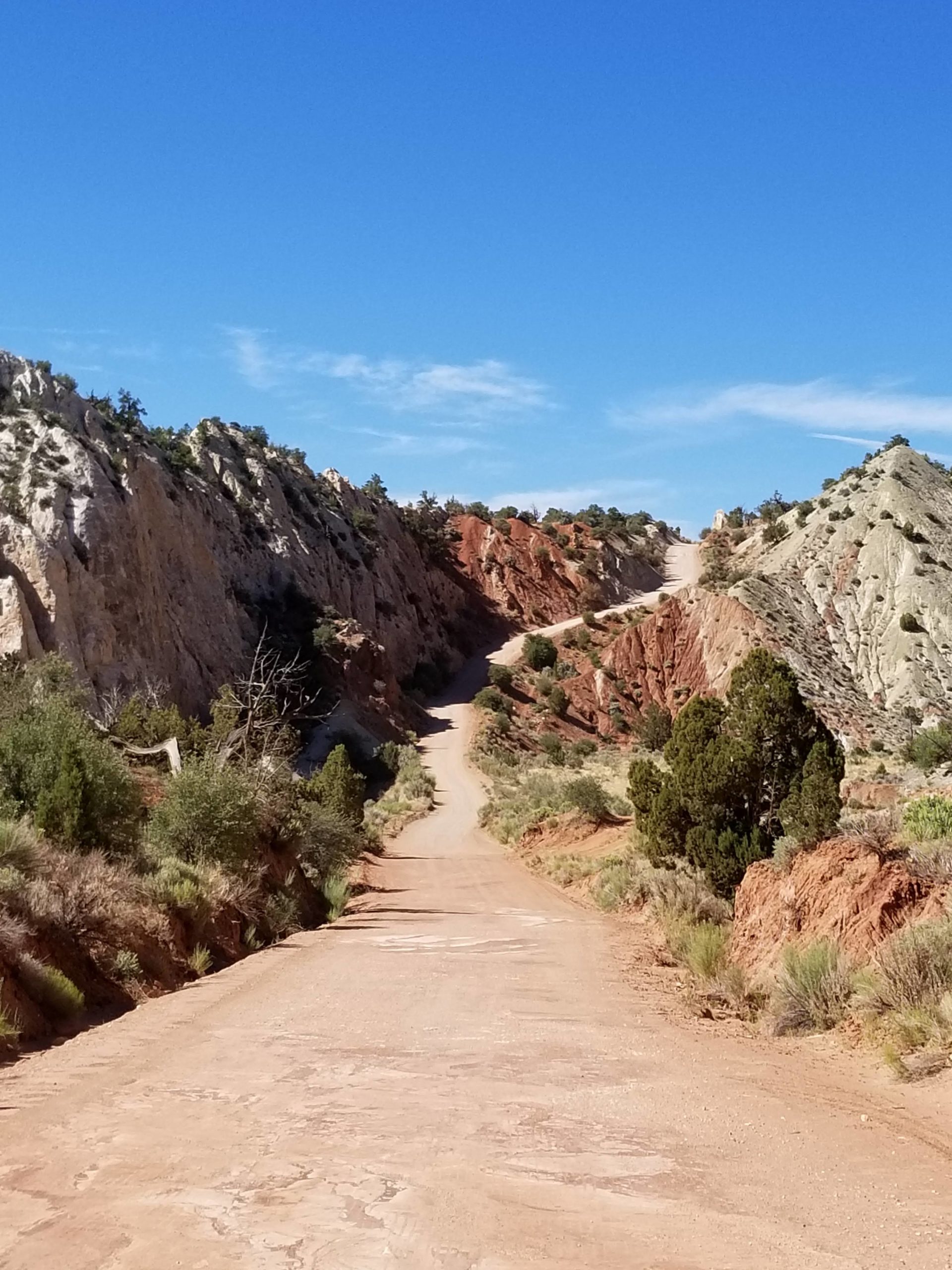
The drive is both exhilarating (we are offroading under the sea, afterall, while accomplishing a goal I have had in the back of my mind for the last six years), but at times it is also monotonous. Periodic valleys filled with endless hoodoos and rock formations are littered between vast plateaus covered by nothing but sagebrush. However, every 10miles or so the scenery changes, we drop into a new valley that is composed of some completely new and amazing color with a novel and eccentric rock formation. But, at the same time, many of the formations are much of the same that we had been seeing for days. It is a special kind of problem to be spoilt by too much grandeur and beauty. We want to be soaking up every sight, every outcropping, but after the first 30 minutes of awe and wonder we sink into a bit of the melancholic monotony. Then, when you are starting to feel just a bit bored and think that you could not possibly be impressed by anything again, a new formation appears and we stop and gawk in awe.
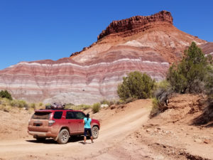
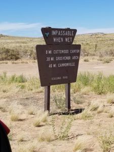
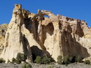
Our first stop is the Paria movie set, which is a ghost town that was rebuilt to film a number of westerns in the 1950s and 60s. After the short detour, we turn onto Cottonwood Road and my excitement level is through the roof–’under the sea’! We mosey down the dirt road, stop periodically for short wanders through narrow slot canyons, and just admire the scenery as it floats on by. We stop by Grosvenor Arch and snap a few photos of the picturesque natural archway. At this point, based on a BLM map I had found, I try to cut over to another main north-south road via some minute trails that are only marked on this single map. Kristen is starting to question my sense of adventure, but I plow ahead even after we come across a small wooden sign that says ‘Road Impassable 24 miles Ahead’. I argue that it is probably for all the tourists in their economy rental cars, no small number of which we have passed with surprise along Cottonwood Road. She rolls her eyes at me, mumbles under her breath, and stares out the window. I argue that ‘they wouldn’t have the roads on the map if they didn’t connect’, then again maybe they would have them on all the maps if they were still in use.
I would say that most decisions I make while traveling have about a 30/70 chance of success, but they are usually weighed against the experience we will have along the way. A majority of the 70% of failures are usually not chalked up as such, because they usually just lead to a new or different route or plan. Travel is like a ‘choose your own adventure’, but, unlike when you are a kid reading a book, you usually just can’t backtrack and restart from your last decision point. Much like life, travel is a complicated branching amoeba where every decision completely alters the future. It is pointless to try and trace where you came from or how you got there or what the alternatives could have been. Your trip is a living creature that necessarily changes as you go. Sure, you might miss out on something due to this decision or that, but whatever you didn’t get to do is replaced by some new adventure, some new chance meeting and encounter. We try to plan just general routes or big things we want to see on a given trip, because overplanning leads to stress and missed opportunity. How will you know where you need to go until you get there and talk to the locals? Guidebooks can only get you so far. There are so many experiences that we have had over the years simply because we made some random decision or missed some bus, although Kristen often argues that my rashness leads to a lot of strenuous exertion and occasional frustration. For instance, after breaking multiple bikes (Cuba), needing to hire a local to canoe our bikes back across a lake in Nepal, and having to bike 20 miles out of the way in the dark because the Nepalese army told us it was too dangerous to go back through the jungle the way we had come (all of these on single speed bikes, of course), Kristen says she will never rent a bike with me in a foreign country again, yet whenever I suggest it anew she seems to jump on the opportunity… As we continue on in the barrenness, dark slowly encroaching on the endless rocky vistas, we get to about mile 15 of this butt jarring dirt road and come across another sign saying that the road is not passable for full size vehicles. Because I am stubborn and refuse to admit defeat until I am staring it straight in the face, I continue a bit further before the road gets a bit too gnarly for my limited skills. We find ourselves on the backbone of a crumbling sand ridge with 200 foot drops on either side and the ‘road’ about as wide as our tire tracks. Luckily, I manage to reverse back into a small forested hill and turn around, realizing I missed a small cactus by about 3 inches.
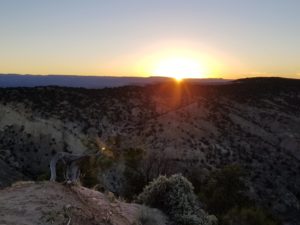
It turns out, sometimes you can backtrack. I admit my defeat, likely gracelessly. But, eventually, a few miles beyond the arch and back on Cottonwood Road we spy a spur road leading up to the top of a small plateau. At the top there is a nice pullout and we make camp on the edge of a badlands canyon looking off in the distance at the red emanating hoodoos of Bryce Canyon. Kristen, in her infinite patience, forgives my meandering and we settle in for another unfathomable sunset. Despite the dead ends, I am in heaven; a day well spent exploring the out of the way crannies of Grand Staircase. Even Kristen agrees that what amounts to about plan G for today was probably not so bad.
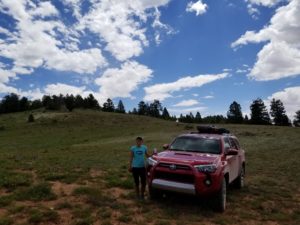
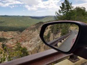
The next day we emerge, dust covered and a little sore from the endless washboards and ruts of the dirt road, but as happy and excited as ever. We start heading east on highway 12 with no real plan, just generally directing our ark towards Capitol Reef National Park (bypassing the crowds of Bryce Canyon and Zion, given that we had both been there and wanted to focus on the less accessible parks). We stop for gas in Cannonville, Utah and I buy a COLD 30 pack of miller lites–oh, the pure bliss and luxury of a cold beer in the desert! Inside the gas station we check the postcards for some ideas of what might be a good detour. In fact, postcards are often my go to for finding local sites. If there is anything of interest to see in an area, the postcard stand in any gift shop or gas station is going to highlight them for you. Honestly, they are better than any guide book and actually show you instead of just describing it in poorly written words (though you are bound to come across some poorly done photoshopping). We notice a number of postcards with pictures of the enticingly named ‘Hell’s Backbone’, which appears to be a narrow dirt road through the equally enticing ‘Box-Death Hollow Wilderness’ within the Dixie National Forest (‘Land of Many Uses’!). So, equipped with this limited information, we pull out our AAA maps, locate the jaggedy, switchbacked road and continue towards a new journey. As we climb up the well maintained gravel road, I see a side trail that appears to climb to the top of a knob that looks like it might have some grand views (and a good place to snack). Apparently I have learned nothing from the previous day. We climb through the trees, do a little rock crawling, and the road empties us into a giant saddle and disappears into a grassy meadow. We get out and choose a random hill to climb just tramping our own path into the wilderness. We end with a nice viewpoint, have a snack, and eventually return to the main road.
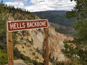
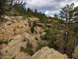
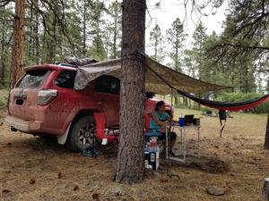
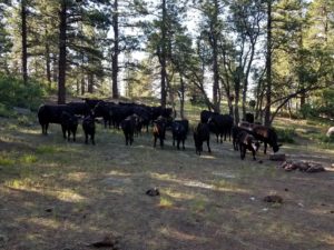
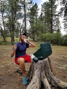
Hell’s Backbone traverses a narrow spire of a ridge, the most intense section being a small bridge connecting across a deep crevasses with views into deep valleys on both sides (I guess this is technically known as a ‘hogsback’). The road was built in the 1930s by some apparently crazy Civilian Conservation Corps (CCC) workers who dubbed it the ‘Poison Road’. It connected Boulder and Escalante, which up until this road was finished relied on mule trains to deliver people and mail. The original bridge was built by laying two logs across the canyon, then the worker who drew the short straw drove a bulldozer across, while he was secured by one piece of rope around his waist; more likely to lead to a hemicorporectomy than to serve as a life line. After crossing the bridge, we find a nice secluded flat pull off in the woods and decide to make camp early and have a nice relaxing afternoon. Unfortunately, we encounter our first rain in awhile and have to hide under our makeshift tarp shelter. We enjoy a little washing off of all the dirt, cool air, cold Miller Lites, and, once again, a beautiful National Forest all to ourselves (except for the herd of cows that wandered into our camp the next morning).

Leave a Reply